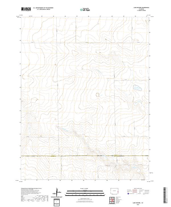
2022 Map of Lake Devore
USGS Topo · Published 2022About this map
The high plains of eastern Colorado meet at the Kiowa Co Prowers Co boundary on this contemporary survey. This largely unpopulated landscape is defined by its intermittent drainage systems and the section-line road network that facilitates transit across the wide-open prairie. The most prominent water feature is Lake Devore, a small catchment situated along a tributary of Wild Horse Cr. The creek and its various branches, such as W Wild Horse Cr, wind across the terrain, illustrating the natural water management patterns of this arid region. The map captures the meticulous grid of county roads, including Co RD G and Co RD 75, which serve the local agricultural and ranching interests along the township and range lines.
Find a feature on this map
22 named features on this map. Tap any name to fly to it.
Don’t see what you’re looking for? This feature index may not catch every label — zoom into the map to look around manually.
Map Details
Editions of this 2022 Lake Devore Map
This is the sole edition of this map. No revisions or reprints were ever made.
Other maps of this area

1890 · Granada
USGS Topo · 1:125,000

1892 · Granada
USGS Topo · 1:125,000

1894 · Granada
USGS Topo · 1:125,000

1954 · Lamar
USGS Topo · 1:250,000

1955 · Holly NE
USGS Topo · 1:24,000

1955 · Granada NE
USGS Topo · 1:24,000
1955 · Holly NW
USGS Topo · 1:24,000

1958 · Lamar
USGS Topo · 1:250,000

1968 · Stuart
USGS Topo · 1:24,000

1968 · Sheridan Lake
USGS Topo · 1:24,000