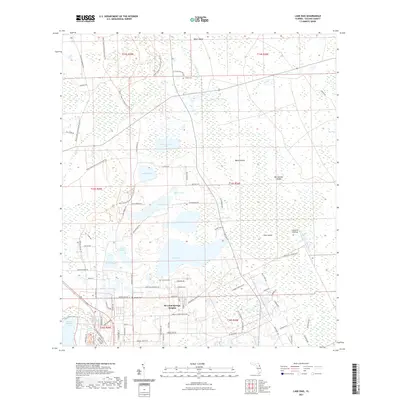
2021 Map of Lake Dias
USGS Topo · Published 2021About this map
De Leon Springs Heights serves as the primary residential hub in this central Florida landscape, characterized by a complex network of wetlands and namesake water bodies. The terrain is defined by low-lying elevations and interior islands like Banks Island and Pine Island, surrounded by the marshy expanse of Tiger Bay and Heart Island. The map reveals a distinct pattern of small, scattered lakes including Lake Winona, Lake Skull, and Dan George Lake, many connected by seasonal drainages like Little Haw Creek and Deep Cr.
Find a feature on this map
91 named features on this map. Tap any name to fly to it.
Don’t see what you’re looking for? This feature index may not catch every label — zoom into the map to look around manually.
Map Details
Editions of this 2021 Lake Dias Map
This is the sole edition of this map. No revisions or reprints were ever made.
Other maps of this area

1937 · Ormond
USGS Topo · 1:48,000

1944 · Ormond
USGS Topo · 1:62,500

1954 · Daytona Beach
USGS Topo · 1:250,000

1956 · Favoretta
USGS Topo · 1:24,000

1958 · Daytona Beach
USGS Topo · 1:250,000

1962 · Daytona Beach NW
USGS Topo · 1:24,000

1962 · Daytona Beach SW
USGS Topo · 1:24,000

1962 · Lake Woodruff
USGS Topo · 1:24,000

1964 · Daytona Beach
USGS Topo · 1:250,000
1964 · De Land
USGS Topo · 1:24,000