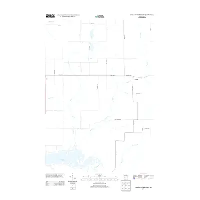
2013 Map of Lake Eau Claire East
USGS Topo · Published 2013About this map
Lake Eau Claire and the Eau Claire River anchor the southern reaches of this landscape, where the river's path winds through a network of smaller tributaries. The small settlement of Wilson sits at a northern crossroads, marking one of the few concentrated points of human habitation in a predominantly agricultural and wooded area. The geography is defined by a dense web of waterways, including Muskrat Cr, Hathaway Cr, and Hay Cr, which carve through the terrain between rural thoroughfares. Local transport is facilitated by a grid of named roads like Stoney Lonesome Rd and Gravel Pit Rd, reflecting the utilitarian nature of the mid-20th-century rural infrastructure. This 2013 survey provides a clear view of the intersection between the natural drainage patterns of the Chippewa County region and the persistent rural road network established decades prior.
Find a feature on this map
27 named features on this map. Tap any name to fly to it.
Don’t see what you’re looking for? This feature index may not catch every label — zoom into the map to look around manually.
Map Details
Editions of this 2013 Lake Eau Claire East Map
This is the sole edition of this map. No revisions or reprints were ever made.
Other maps of this area

1935 · Osseo
USGS Topo · 1:48,000

1940 · Osseo
USGS Topo · 1:62,500

1948 · Fairchild
USGS Topo · 1:62,500

1949 · Fairchild
USGS Topo · 1:62,500

1952 · Cadott
USGS Topo · 1:62,500

1952 · Stanley
USGS Topo · 1:62,500

1953 · Eau Claire
USGS Topo · 1:250,000

1958 · Eau Claire
USGS Topo · 1:250,000

1964 · Eau Claire
USGS Topo · 1:250,000
1968 · Osseo
USGS Topo · 1:62,500