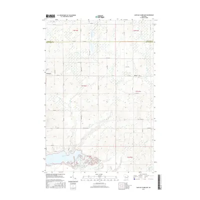
2015 Map of Lake Eau Claire East
USGS Topo · Published 2015About this map
Lake Eau Claire and the Eau Claire River dominate the southern landscape of this 2015 survey, where the water system is fed by numerous drainages including Muskrat Cr and Hathaway Cr. The terrain straddles the border of Chippewa and Eau Claire counties, revealing a rural network of named roads and family-linked landmarks. Small community centers are represented by Ludington in the west and Wilson to the east, each anchored by local burial grounds such as the Ludington Cem and Saint Peter Cem. The map illustrates a modern rural Wisconsin layout, defined by the Public Land Survey System grids of T27N and T28N, where traditional agricultural land is intersected by a complex hydrographic web of creeks like Sherman Cr and Hay Cr.
Find a feature on this map
48 named features on this map. Tap any name to fly to it.
Don’t see what you’re looking for? This feature index may not catch every label — zoom into the map to look around manually.
Map Details
Editions of this 2015 Lake Eau Claire East Map
This is the sole edition of this map. No revisions or reprints were ever made.
Other maps of this area

1935 · Osseo
USGS Topo · 1:48,000

1940 · Osseo
USGS Topo · 1:62,500

1948 · Fairchild
USGS Topo · 1:62,500

1949 · Fairchild
USGS Topo · 1:62,500

1952 · Cadott
USGS Topo · 1:62,500

1952 · Stanley
USGS Topo · 1:62,500

1953 · Eau Claire
USGS Topo · 1:250,000

1958 · Eau Claire
USGS Topo · 1:250,000

1964 · Eau Claire
USGS Topo · 1:250,000
1968 · Osseo
USGS Topo · 1:62,500