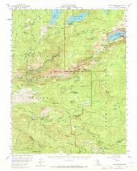
1956 Map of Lake Eleanor
USGS Topo · Published 1972About this map
The High Sierra water system dominates this mid-century landscape, centered on the Hetch Hetchy Reservoir and Lake Eleanor. Following the 1956 field check, the map illustrates the massive engineering of the O'Shaughnessy Dam and the Hetch Hetchy Aqueduct snaking through the Stanislaus National Forest. Beyond the civil works, the land preserves a record of mountain habitation at Meyers Ranch, Hodgdon Ranch, and the Hazel Green Ranch near the Tuolumne-Mariposa line.
Find a feature on this map
70 named features on this map. Tap any name to fly to it.
Don’t see what you’re looking for? This feature index may not catch every label — zoom into the map to look around manually.
Map Details
Editions of this 1956 Lake Eleanor Map
3 editions found
Other maps of this area

1891 · Big Trees
USGS Topo · 1:125,000

1893 · Sonora
USGS Topo · 1:125,000

1894 · Big Trees
USGS Topo · 1:125,000

1896 · Dardanelles
USGS Topo · 1:125,000

1896 · Sonora
USGS Topo · 1:125,000

1897 · Sonora
USGS Topo · 1:125,000

1897 · Big Trees
USGS Topo · 1:125,000

1897 · Yosemite
USGS Topo · 1:125,000

1898 · Dardanelles
USGS Topo · 1:125,000

1898 · Sonora
USGS Topo · 1:125,000