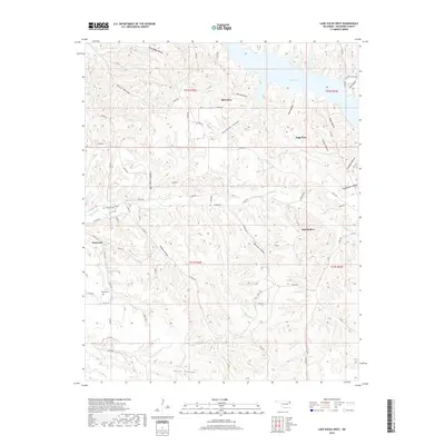
2018 Map of Lake Eucha West
USGS Topo · Published 2018About this map
Old Eucha and Kenwood anchor this landscape in Delaware County, where the hills are deeply incised by a dense network of hollows feeding into the Spavinaw Creek basin. The topography is defined by narrow ridges and named valleys like Galcatcher Hollow, Proctor Hollow, and Spade Hollow. The northern portion of the map is dominated by the western reaches of Lake Eucha, where the terrain transitions from upland flats such as Tagg Flats to the submerged river valley. Genealogical interest is centered on several burial sites, including the Old Eucha Cem near the shoreline and the Welsh Cem further south. The drainage patterns of Saline Cr and Little Saline Cr dictate the local road network, which consists largely of section-line routes and winding paths like Kenwood RD that follow the natural contours of the Ozark plateau foothills.
Find a feature on this map
72 named features on this map. Tap any name to fly to it.
Don’t see what you’re looking for? This feature index may not catch every label — zoom into the map to look around manually.
Map Details
Editions of this 2018 Lake Eucha West Map
This is the sole edition of this map. No revisions or reprints were ever made.
Other maps of this area

1896 · Pryor
USGS Topo · 1:125,000

1899 · Siloam Springs
USGS Topo · 1:125,000

1901 · Pryor
USGS Topo · 1:125,000

1903 · Siloam Springs
USGS Topo · 1:125,000

1904 · Siloam Springs
USGS Topo · 1:125,000

1954 · Tulsa
USGS Topo · 1:250,000

1958 · Tulsa
USGS Topo · 1:250,000

1963 · Tulsa
USGS Topo · 1:250,000

1971 · Kenwood
USGS Topo · 1:24,000

1971 · Jay SE
USGS Topo · 1:24,000