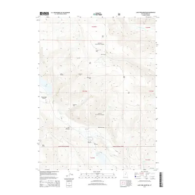
2014 Map of Lake Fork Mountain
USGS Topo · Published 2014About this map
Moon Lake Resort serves as a primary destination in this high-altitude corner of the Ashley National Forest, where the transition from alpine waters to canyon draws defines the topography. The Lake Fork River is the central hydrologic feature, fed by tributaries like Mule Cr and Petty Cr as it flows south toward the Twin Pots Reservoir. This 2014 survey captures a landscape balanced between recreational development and traditional land use, evidenced by the presence of the Beaver Dam Campground alongside the Lake Fork Corral and Fisher Ranch. Topographic landmarks such as Lake Fork Mtn and the steep descent of Hells Canyon provide a detailed look at the geological character of Duchesne County. Noteworthy structural details like the Upper Moon Lake Canal Bridge and Twin Pots Bridge document the water management and transportation infrastructure required to navigate this portion of the Uintah Meridian.
Find a feature on this map
37 named features on this map. Tap any name to fly to it.
Don’t see what you’re looking for? This feature index may not catch every label — zoom into the map to look around manually.
Map Details
Editions of this 2014 Lake Fork Mountain Map
This is the sole edition of this map. No revisions or reprints were ever made.
Other maps of this area

1885 · Uinta
USGS Topo · 1:250,000

1901 · Hayden Peak
USGS Topo · 1:125,000

1903 · Hayden Peak
USGS Topo · 1:125,000

1905 · Gilbert Peak
USGS Topo · 1:125,000

1906 · Gilbert Peak
USGS Topo · 1:125,000

1939 · Duchesne
USGS Topo · 1:125,000

1954 · Salt Lake City
USGS Topo · 1:250,000

1958 · Salt Lake City
USGS Topo · 1:250,000

1960 · Salt Lake City
USGS Topo · 1:250,000

1962 · Dry Mountain
USGS Topo · 1:24,000