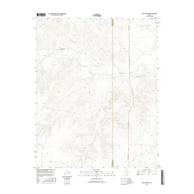
2016 Map of Lake Fryer NE
USGS Topo · Published 2016About this map
Ochiltree Co and Lipscomb Co meet along a straight meridian in this high plains landscape, defined by a complex network of drainage systems. The northern reaches of the map are dominated by the winding path of Wolf Cr, which is fed by the distinct Cottonwood Arroyo. These watercourses have carved significant relief into the terrain, creating a series of draws and ridges that contrast with the more level sections found in the south.
Find a feature on this map
16 named features on this map. Tap any name to fly to it.
Don’t see what you’re looking for? This feature index may not catch every label — zoom into the map to look around manually.
Map Details
Editions of this 2016 Lake Fryer NE Map
This is the sole edition of this map. No revisions or reprints were ever made.
Other maps of this area

1954 · Perryton
USGS Topo · 1:250,000

1958 · Perryton
USGS Topo · 1:250,000

1972 · Barton Corners
USGS Topo · 1:24,000
1972 · Lipscomb SW
USGS Topo · 1:24,000

1972 · Twin Grove
USGS Topo · 1:24,000

1972 · Booker SE
USGS Topo · 1:24,000

1973 · Booker SW
USGS Topo · 1:24,000

1973 · Pickett Ranch Creek
USGS Topo · 1:24,000

1973 · Lake Fryer
USGS Topo · 1:24,000
1973 · Barton Creek
USGS Topo · 1:24,000