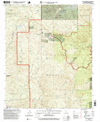
1996 Map of Lake Fulmor
USGS Topo · Published 1999About this map
The San Jacinto River flows through this high-altitude landscape within the San Bernardino National Forest, a region defined by its steep ridges and scattered water sources. In the mid-1990s, the area supported specialized institutions such as the Twin Pines Ranch and Mount Oak Boys Ranch in the northern reaches, while the small settlement of Alandale marks a rare point of residential concentration near the southern boundary. Steep terrain is dominated by summits like Black Mtn and Ranger Peak, with numerous springs like Peach Tree Spring and Oak Spring providing critical water in the arid heights.
Find a feature on this map
3 named features on this map. Tap any name to fly to it.
Don’t see what you’re looking for? This feature index may not catch every label — zoom into the map to look around manually.
Map Details
Editions of this 1996 Lake Fulmor Map
This is the sole edition of this map. No revisions or reprints were ever made.
Other maps of this area

1901 · Southern California Sheet No. 1
USGS Topo · 1:250,000

1901 · San Jacinto
USGS Topo · 1:125,000

1904 · Southern California Sheet No. 1
USGS Topo · 1:250,000

1940 · Palm Springs
USGS Topo · 1:62,500

1940 · Hemet Reservoir
USGS Topo · 1:62,500

1942 · Banning
USGS Topo · 1:62,500

1942 · Hemet Reservoir
USGS Topo · 1:62,500

1942 · Hemet
USGS Topo · 1:62,500

1943 · Hemet
USGS Topo · 1:62,500

1943 · Banning
USGS Topo · 1:62,500