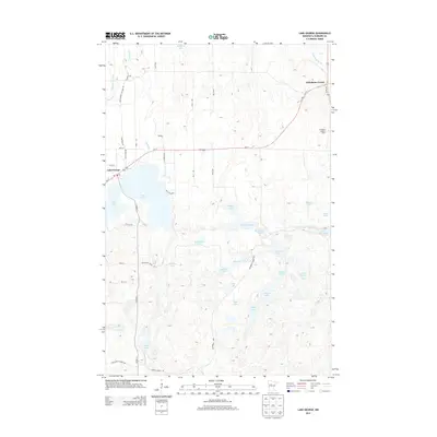
2013 Map of Lake George
USGS Topo · Published 2013About this map
Lake George serves as the central focal point of this Hubbard County landscape, surrounded by a dense network of glacial lakes and small watercourses. The settlement of Lake George itself is situated on the northwestern shore, featuring a local Post Office and connecting to the surrounding region via roads like Lake George Twp Hwy 68. To the northeast, Kabekona Corner marks a secondary concentration of activity near the headwaters of the Kabekona River, while the Kabekona Lookout Tower stands as a distinct landmark on the higher ground overlooking the river valley. The terrain is defined by its complex hydrography, including the winding Schoolcraft River and a multitude of smaller bodies such as Deep Lake, Halverson Lake, and Kahlstorf Lake. This 2013 survey illustrates the modern road network, including forestry access routes like Halvorson Forest Rd and the aptly named Steamboat Pass, which navigate the intricate wetland and lake systems.
Find a feature on this map
47 named features on this map. Tap any name to fly to it.
Don’t see what you’re looking for? This feature index may not catch every label — zoom into the map to look around manually.
Map Details
Editions of this 2013 Lake George Map
This is the sole edition of this map. No revisions or reprints were ever made.
Other maps of this area

1954 · Bemidji
USGS Topo · 1:250,000

1957 · Bemidji
USGS Topo · 1:250,000

1958 · Bemidji
USGS Topo · 1:250,000

1968 · Guthrie
USGS Topo · 1:24,000

1968 · Frontenac Lake
USGS Topo · 1:24,000
1972 · Mantrap Lake
USGS Topo · 1:24,000
1972 · East Crooked Lake
USGS Topo · 1:24,000

1972 · Laporte
USGS Topo · 1:24,000

1972 · Lake George
USGS Topo · 1:24,000
1972 · Lake Hattie
USGS Topo · 1:24,000
Featured Places
- Lake George, MN
- Ken and Debi Lathrop Mobile Home Park, MN
- Kabekona Corner, MN
- Lake George Pines Mobile Home Park, MN
- Hubbard County, MN