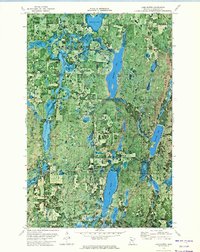
1972 Map of Lake Hattie
USGS Topo · Published 1974About this map
Mississippi Headwaters State Forest and Rockwood State Forest dominate this wooded lake district in Hubbard County. This 1972 orthophotomap provides a rare hybrid view, combining traditional topographic contours with aerial imagery to reveal the dense timber and intricate wetlands of the north woods. The landscape is defined by its glacial hydrology, where Hennepin Lake and Lake Hattie sit amidst a network of smaller basins like Diamond Lake and Evergreen Lake.
Find a feature on this map
21 named features on this map. Tap any name to fly to it.
Don’t see what you’re looking for? This feature index may not catch every label — zoom into the map to look around manually.
Map Details
Editions of this 1972 Lake Hattie Map
This is the sole edition of this map. No revisions or reprints were ever made.
Other maps of this area

1954 · Bemidji
USGS Topo · 1:250,000

1957 · Bemidji
USGS Topo · 1:250,000

1958 · Bemidji
USGS Topo · 1:250,000

1968 · Frontenac Lake
USGS Topo · 1:24,000

1968 · Bemidji West
USGS Topo · 1:24,000

1972 · Alida
USGS Topo · 1:24,000

1972 · La Salle Lake
USGS Topo · 1:24,000
1972 · Grant Lake
USGS Topo · 1:24,000
1972 · Lake Itasca
USGS Topo · 1:24,000

1972 · Lake George
USGS Topo · 1:24,000