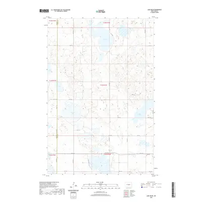
2020 Map of Lake Helen
USGS Topo · Published 2020About this map
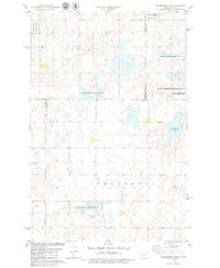
Lake Helen and Lake Josephine anchor this landscape of the North Dakota pothole region, where the prairie is defined by numerous seasonal basins and permanent water bodies. The boundary between Burleigh County and Kidder County runs vertically through the quadrangle, dividing a terrain shaped by the Public Land Survey System’s rigid township and range grid. This agricultural and wetland mosaic is navigated by a network of sectional roads such as 16th St SE and 21st Ave SE. In the southeastern corner, the Tuttle Cem provides a specific point of genealogical interest near the junction of 19th St SE and 23rd Ave SE. Other significant wetlands including Hutchinson Lake, Rush Lake, and Twin Lakes illustrate the complex hydrology typical of this part of the Great Plains.
Find a feature on this map
27 named features on this map. Tap any name to fly to it.
Don’t see what you’re looking for? This feature index may not catch every label — zoom into the map to look around manually.
Map Details
Editions of this 2020 Lake Helen Map
This is the sole edition of this map. No revisions or reprints were ever made.
Other maps of this area

1952 · New Rockford
USGS Topo · 1:250,000

1954 · McClusky
USGS Topo · 1:250,000

1956 · New Rockford
USGS Topo · 1:250,000

1958 · McClusky
USGS Topo · 1:250,000

1971 · New Rockford
USGS Topo · 1:250,000

1972 · Tuttle
USGS Topo · 1:24,000
1972 · Tuttle SW
USGS Topo · 1:24,000
1978 · Goodrich SW
USGS Topo · 1:24,000
1978 · Senior Lake
USGS Topo · 1:24,000
1978 · Woodhouse Lake
USGS Topo · 1:24,000