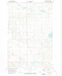
1972 Map of Tuttle SW
USGS Topo · Published 1974About this map
The glaciated plains of Kidder County, North Dakota, are defined by numerous prairie potholes and wetlands in this early 1970s survey. A central Townhall serves as a small civic landmark amidst the township divisions of Haynes, Tuttle, and Hestina. Large water bodies like Clear Lake and Cherry Lake include designated Public Access points, reflecting the region's importance for local recreation and conservation. The northern reaches include a National Waterfowl Production Area, highlighting the landscape's role within the migratory flyway. Evidence of local infrastructure and resource extraction appears through several Gravel Pits and a solitary Gravel Pit scattered across the undulating terrain. This map records the prairie landscape before modern agricultural or drainage changes altered the density of these seasonal and permanent wetlands.
Find a feature on this map
11 named features on this map. Tap any name to fly to it.
Don’t see what you’re looking for? This feature index may not catch every label — zoom into the map to look around manually.
Map Details
Editions of this 1972 Tuttle SW Map
2 editions found
Other maps of this area

1951 · Driscoll
USGS Topo · 1:62,500

1952 · Steele NE
USGS Topo · 1:24,000

1952 · Steele NW
USGS Topo · 1:24,000

1952 · New Rockford
USGS Topo · 1:250,000

1953 · Jamestown
USGS Topo · 1:250,000

1954 · Bismarck
USGS Topo · 1:250,000

1954 · McClusky
USGS Topo · 1:250,000

1956 · New Rockford
USGS Topo · 1:250,000

1956 · Jamestown
USGS Topo · 1:250,000

1958 · Bismarck
USGS Topo · 1:250,000