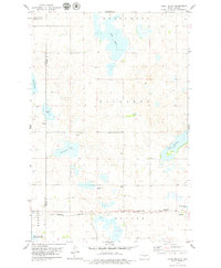
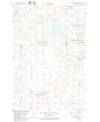
1979 Map of Lake Helen
USGS Topo · Published 1979About this map
Glacial prairie potholes and scattered wetlands define this section of the North Dakota landscape, where the Lake Helen and Lake Josephine basins dominate the topography. The terrain is a complex of depressions and rises across the townships of Kickapoo, Tuttle, and Harriet. Human imprint is most visible along the southern corridor, where the Burlington Northern railroad cuts through the prairie. Near the tracks, the Tuttle Cem and adjacent Sewage Disposal Ponds mark the proximity of local settlement just off the sheet. To the west, the Arena State Game Management Area protects a portion of the wetlands, including portions of Twin Lakes. The map also captures smaller water bodies like Rush Lake and Hutchinson Lake, alongside a functional Gravel Pit, illustrating the region's mix of conservation and resource extraction in the late 1970s.
Find a feature on this map
15 named features on this map. Tap any name to fly to it.
Don’t see what you’re looking for? This feature index may not catch every label — zoom into the map to look around manually.
Map Details
Editions of this 1979 Lake Helen Map
This is the sole edition of this map. No revisions or reprints were ever made.
Other maps of this area

1952 · New Rockford
USGS Topo · 1:250,000

1954 · McClusky
USGS Topo · 1:250,000

1956 · New Rockford
USGS Topo · 1:250,000

1958 · McClusky
USGS Topo · 1:250,000

1971 · New Rockford
USGS Topo · 1:250,000

1972 · Tuttle
USGS Topo · 1:24,000
1972 · Tuttle SW
USGS Topo · 1:24,000
1978 · Goodrich SW
USGS Topo · 1:24,000
1978 · Senior Lake
USGS Topo · 1:24,000
1978 · Woodhouse Lake
USGS Topo · 1:24,000