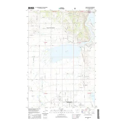
2017 Map of Lake Helena
USGS Topo · Published 2017About this map
Lake Helena and the surrounding valley floor are defined by a complex network of water management and natural drainage systems, where Prickly Pear Cr and Tenmile Cr feed into the lake's basin. The landscape reflects the suburban expansion of the Montana capital's outskirts, with residential developments like Helena Valley Southeast and Helena Valley Northeast spreading toward the base of the mountains. To the northeast, the terrain rises sharply into the Helena National Forest, overlooking the waters of Hauser Lake. Infrastructure is prominent throughout the quadrangle, from the Helena Valley Canal and Helena Valley Reservoir to the grid of rural roads and residential lanes. For those researching local burial sites, the Hardgrove & Merritt Cem is located east of the lake. This 2017 survey provides a high-resolution look at the balance between the area's agricultural heritage and its modern residential growth near the Missouri River corridor.
Find a feature on this map
103 named features on this map. Tap any name to fly to it.
Don’t see what you’re looking for? This feature index may not catch every label — zoom into the map to look around manually.
Map Details
Editions of this 2017 Lake Helena Map
This is the sole edition of this map. No revisions or reprints were ever made.
Other maps of this area

1886 · Fort Logan
USGS Topo · 1:250,000

1889 · Helena
USGS Topo · 1:250,000

1893 · Helena
USGS Topo · 1:250,000

1899 · Helena
USGS Topo · 1:62,500

1899 · Helena
USGS Topo · 1:250,000

1903 · Helena
USGS Topo · 1:250,000

1947 · Butte
USGS Topo · 1:250,000

1948 · White Sulphur Springs
USGS Topo · 1:250,000

1950 · East Helena
USGS Topo · 1:62,500

1950 · Helena
USGS Topo · 1:62,500