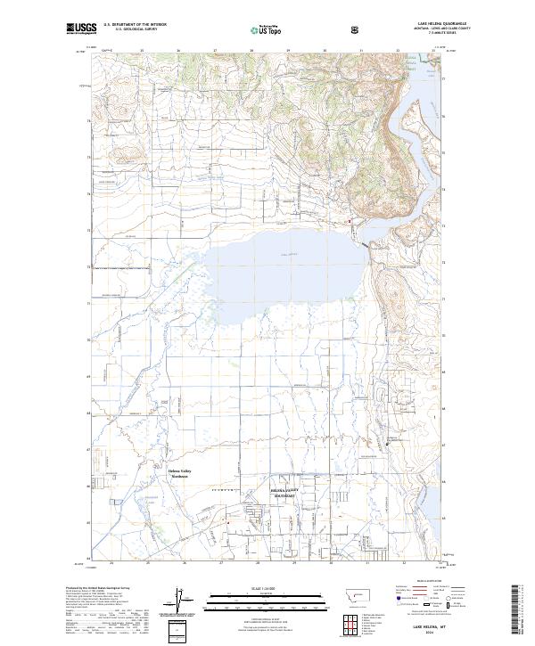
2024 Map of Lake Helena
USGS Topo · Published 2024About this map
Lake Helena dominates this landscape, serving as a focal point for a complex network of irrigation and natural drainage in the northern reaches of the valley. The expansive Helena Valley Canal and the Helena Regulating Reservoir infrastructure illustrate the engineered water management essential to the region's agricultural and residential development. To the south, the census-designated areas of Helena Valley Northeast and Helena Valley Southeast show a transition from open terrain to more structured suburban settlements, including the neighborhood at Stansfield.
Find a feature on this map
113 named features on this map. Tap any name to fly to it.
Don’t see what you’re looking for? This feature index may not catch every label — zoom into the map to look around manually.
Map Details
Editions of this 2024 Lake Helena Map
This is the sole edition of this map. No revisions or reprints were ever made.
Other maps of this area

1886 · Fort Logan
USGS Topo · 1:250,000

1889 · Helena
USGS Topo · 1:250,000

1893 · Helena
USGS Topo · 1:250,000

1899 · Helena
USGS Topo · 1:62,500

1899 · Helena
USGS Topo · 1:250,000

1903 · Helena
USGS Topo · 1:250,000

1947 · Butte
USGS Topo · 1:250,000

1948 · White Sulphur Springs
USGS Topo · 1:250,000

1950 · East Helena
USGS Topo · 1:62,500

1950 · Helena
USGS Topo · 1:62,500