
1888 Map of Lake Hopatcong
USGS Topo · Published 1888About this map
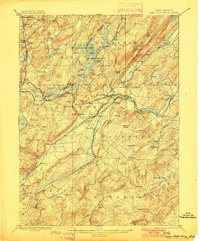
Lake Hopatcong serves as the central focal point of this late-nineteenth-century landscape, its shoreline defined by complex coves and islands such as Halsey Island and the River Styx inlet. The map illustrates a region in the midst of an industrial and transit evolution, where the serpentine path of the Morris Canal intersects with a dense network of iron-era transport. The Delaware Lackawanna and Western Railroad and the High Bridge Branch of Central Railroad of New Jersey cut through the terrain, connecting established iron-mining and industrial centers like Port Oram, Dover, and Mt Hope. This survey provides a clear view of the rural and industrial geography of Morris County and southern Sussex County before modern suburbanization. Genealogists and historians can locate early hamlets and stations such as Vanatta Station, Drakesville, and Hacklebarney, alongside numerous named watercourses like the Whippany River and Black River that powered the area's early development.
Find a feature on this map
103 named features on this map. Tap any name to fly to it.
Don’t see what you’re looking for? This feature index may not catch every label — zoom into the map to look around manually.
Map Details
Editions of this 1888 Lake Hopatcong Map
This is the sole edition of this map. No revisions or reprints were ever made.
Historical Maps of Hilltop Estates Through Time
4 maps found

Featured Locations
- Rockaway Township, NJ
- Roxbury Township, NJ
- Mount Olive, NJ
- Parsippany-Troy Hills, NJ
- Sparta Township, NJ