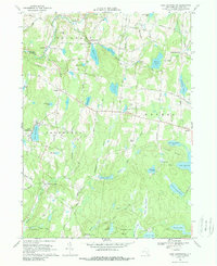
1967 Map of Lake Huntington
USGS Topo · Published 1989About this map
Lake Huntington and the surrounding hamlets of western Sullivan County are depicted during a period of established recreation and rural life. The landscape is dominated by a high density of water bodies, including Kenoza Lake, Toronto Lake, and the expansive Lake Superior, suggesting the area's importance for seasonal camps and tourism. Settlement patterns are concentrated at crossroads like Fosterdale and the Hurd Settlement, while the southern reaches feature the Tenmile River Camps near the winding Tenmile River. The map captures the network of local roads such as Jaketown Road and Puckyhuddle Road that connected these scattered communities and lakeside retreats. Local industry is represented by small-scale resource extraction like the Quarry near Pine Lake and a Gravel Pit along the Tenmile River, providing a look at the mid-century infrastructure supporting this Catskills region.
Find a feature on this map
73 named features on this map. Tap any name to fly to it.
Don’t see what you’re looking for? This feature index may not catch every label — zoom into the map to look around manually.
Map Details
Editions of this 1967 Lake Huntington Map
2 editions found
Other maps of this area

1920 · Long Eddy
USGS Topo · 1:62,500

1920 · Damascus
USGS Topo · 1:62,500

1921 · Long Eddy
USGS Topo · 1:48,000

1921 · Livingston Manor
USGS Topo · 1:62,500

1922 · White Lake
USGS Topo · 1:62,500

1923 · Damascus
USGS Topo · 1:62,500

1923 · Long Eddy
USGS Topo · 1:62,500

1923 · Livingston Manor
USGS Topo · 1:62,500

1942 · White Lake
USGS Topo · 1:62,500

1943 · Honesdale
USGS Topo · 1:125,000