
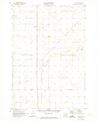
1970 Map of Lake Hurley
USGS Topo · Published 1972About this map
Lake Oahe dominates the western edge of this Potter County landscape, illustrating the transformative impact of mid-century Missouri River damming on the local topography. This 1970 field-checked survey reveals the interface between the newly created reservoir at Whitlocks Bay Recreation Area and the traditional prairie uplands divided into the civil townships of South Riverside, Appomattox, Forest City, and Sanner. The map documents localized rural development through features like the Forest City Sch and the Ebach Landing Strip, while the northern portion focuses on the hydrological management of Lake Hurley, including its Spillway and the winding course of Little Cheyenne Creek. Geologists and local historians can trace the transition from alluvial Missouri bottomlands to the engineered shoreline of the Oahe reservoir as it appeared five decades ago.
Find a feature on this map
13 named features on this map. Tap any name to fly to it.
Don’t see what you’re looking for? This feature index may not catch every label — zoom into the map to look around manually.
Map Details
Editions of this 1970 Lake Hurley Map
This is the sole edition of this map. No revisions or reprints were ever made.
Other maps of this area

1953 · McIntosh
USGS Topo · 1:250,000

1954 · Pierre
USGS Topo · 1:250,000

1958 · Pierre
USGS Topo · 1:250,000

1958 · McIntosh
USGS Topo · 1:250,000

1969 · Four Bear Creek
USGS Topo · 1:24,000

1969 · Patch Skin Buttes SE
USGS Topo · 1:24,000

1970 · Steamboat Creek
USGS Topo · 1:24,000

1970 · Lake Hurley NE
USGS Topo · 1:24,000

1970 · Agar NW
USGS Topo · 1:24,000
1970 · Agar NE
USGS Topo · 1:24,000