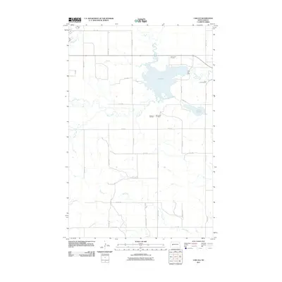
2011 Map of Lake Ilo
USGS Topo · Published 2011About this map
Lake Ilo and its surrounding wetlands define this prairie landscape in western North Dakota. Created by the Lake Ilo Dam along Spring Creek, the reservoir is a central water feature in a region dominated by agricultural grid-lines and intermittent drainage. The map documents significant local landmarks for genealogists and historians, including the Dunn Center Cemetery to the northeast and the dual-labeled Mormannia Cemetery situated south of the lake. The terrain is further shaped by the meandering paths of Murphy Creek and Stray Creek, which cut through the open country. This 2011 survey captures the area's rural character and vital water management infrastructure, including the marshy expanse of Le Paul Slough at the eastern edge of the water body.
Find a feature on this map
24 named features on this map. Tap any name to fly to it.
Don’t see what you’re looking for? This feature index may not catch every label — zoom into the map to look around manually.
Map Details
Editions of this 2011 Lake Ilo Map
This is the sole edition of this map. No revisions or reprints were ever made.
Other maps of this area

1953 · Watford City
USGS Topo · 1:250,000

1957 · Watford City
USGS Topo · 1:250,000

1967 · Watford City
USGS Topo · 1:250,000

1970 · Dunn Center NW
USGS Topo · 1:24,000

1970 · Dunn Center NE
USGS Topo · 1:24,000

1973 · Ziner Butte
USGS Topo · 1:24,000

1973 · Manning
USGS Topo · 1:24,000

1973 · Dunn Center
USGS Topo · 1:24,000

1973 · Emerson
USGS Topo · 1:24,000

1973 · Lake Ilo
USGS Topo · 1:24,000