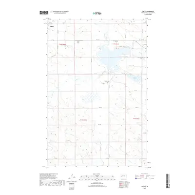
2017 Map of Lake Ilo
USGS Topo · Published 2017About this map
Lake Ilo dominates the landscape of this Dunn County region, serving as a central catchment for the winding waters of Spring Creek and Murphy Creek. Located just east of the city of Killdeer, the area reflects a structured prairie landscape defined by the Public Land Survey System, with a dense grid of section-line roads like 4th Street SW and 7th Street SW providing access to the surrounding farmsteads.
Find a feature on this map
28 named features on this map. Tap any name to fly to it.
Don’t see what you’re looking for? This feature index may not catch every label — zoom into the map to look around manually.
Map Details
Editions of this 2017 Lake Ilo Map
This is the sole edition of this map. No revisions or reprints were ever made.
Other maps of this area

1953 · Watford City
USGS Topo · 1:250,000

1957 · Watford City
USGS Topo · 1:250,000

1967 · Watford City
USGS Topo · 1:250,000

1970 · Dunn Center NW
USGS Topo · 1:24,000

1970 · Dunn Center NE
USGS Topo · 1:24,000

1973 · Ziner Butte
USGS Topo · 1:24,000

1973 · Manning
USGS Topo · 1:24,000

1973 · Dunn Center
USGS Topo · 1:24,000

1973 · Emerson
USGS Topo · 1:24,000

1973 · Lake Ilo
USGS Topo · 1:24,000