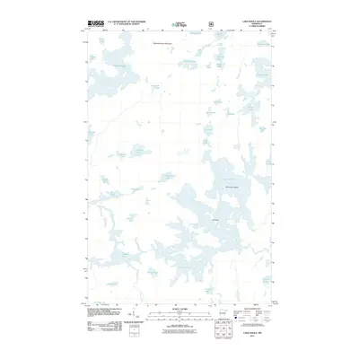
2011 Map of Lake Insula
USGS Topo · Published 2011About this map
Lake Insula dominates this water-rich landscape in Lake County, serving as the centerpiece for an intricate network of interconnected basins and islands. This area of Crystal Bay Township exhibits a dense glacial geography where navigation is defined by narrow passages and significant terrain markers like The Rock and Williamson Island. To the north, Disappointment Mountain rises as a prominent landmark overlooking Disappointment Lake and Muzzle Lake. The complex hydrology is further characterized by the flow of Drumstick Creek and the isolation of smaller bodies such as Starlight Lake and Museum Lake. Unlike many regions defined by roads and human infrastructure, this survey illustrates a wilderness-oriented environment where natural features—from the larger Thomas Lake to the small Vivid Lake—dictate the layout of the land.
Find a feature on this map
41 named features on this map. Tap any name to fly to it.
Don’t see what you’re looking for? This feature index may not catch every label — zoom into the map to look around manually.
Map Details
Editions of this 2011 Lake Insula Map
This is the sole edition of this map. No revisions or reprints were ever made.
Other maps of this area

1954 · Two Harbors
USGS Topo · 1:250,000

1957 · Two Harbors
USGS Topo · 1:250,000

1957 · Ensign Lake
USGS Topo · 1:62,500

1957 · Quetico
USGS Topo · 1:250,000

1958 · Two Harbors
USGS Topo · 1:250,000

1959 · Kekekabic Lake
USGS Topo · 1:24,000

1960 · Perent Lake
USGS Topo · 1:24,000

1960 · Alice Lake
USGS Topo · 1:24,000

1964 · Two Harbors
USGS Topo · 1:250,000

1968 · Quetico
USGS Topo · 1:250,000