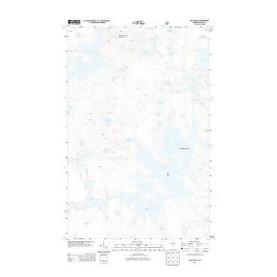
2013 Map of Lake Insula
USGS Topo · Published 2013About this map
Lake Insula dominates this northern Minnesota landscape, where an intricate network of glacial lakes and portages defines the terrain. The central water body is punctuated by Williamson Island and a notable landmark simply labeled The Rock. This area is characterized by its high concentration of small, interconnected water bodies, such as Kiana Lake, Sable Lake, and Coon Lake, which likely served as vital corridors for travel in the wilderness. To the north, the elevation rises toward Disappointment Mountain, overlooking the large expanse of Disappointment Lake. The absence of roads or permanent settlements on this sheet highlights the primitive state of the region in the early 21st century. Instead, features like Drumstick Cr and Museum Lake provide a detailed look at the complex hydrography and natural drainage patterns of this lake-heavy environment.
Find a feature on this map
44 named features on this map. Tap any name to fly to it.
Don’t see what you’re looking for? This feature index may not catch every label — zoom into the map to look around manually.
Map Details
Editions of this 2013 Lake Insula Map
This is the sole edition of this map. No revisions or reprints were ever made.
Other maps of this area

1954 · Two Harbors
USGS Topo · 1:250,000

1957 · Two Harbors
USGS Topo · 1:250,000

1957 · Ensign Lake
USGS Topo · 1:62,500

1957 · Quetico
USGS Topo · 1:250,000

1958 · Two Harbors
USGS Topo · 1:250,000

1959 · Kekekabic Lake
USGS Topo · 1:24,000

1960 · Perent Lake
USGS Topo · 1:24,000

1960 · Alice Lake
USGS Topo · 1:24,000

1964 · Two Harbors
USGS Topo · 1:250,000

1968 · Quetico
USGS Topo · 1:250,000