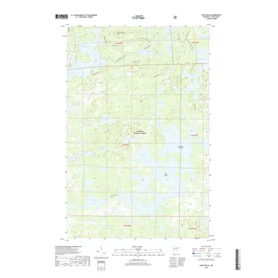
2019 Map of Lake Insula
USGS Topo · Published 2019About this map
Lake Insula and its intricate network of island-dotted waters anchor this portion of the Superior National Forest in northern Minnesota. This landscape is defined by the labyrinthine connectivity of the Boundary Waters, where portages and trails link isolated water bodies like Disappointment Lake and Thomas Lake. The topographic relief is marked by prominent high points such as Disappointment Mtn and unique features like The Rock, situated amidst the vast aquatic expanse. Historical transit patterns are visible through established wilderness routes, including the Kekekabic Trail and various portage connectors like the Hudson - Insula and Kiana - Insula paths. These trails highlight the long-standing importance of water-and-land travel in a region where Williamson Island and other landforms served as vital navigation markers for paddlers and foresters alike.
Find a feature on this map
57 named features on this map. Tap any name to fly to it.
Don’t see what you’re looking for? This feature index may not catch every label — zoom into the map to look around manually.
Map Details
Editions of this 2019 Lake Insula Map
This is the sole edition of this map. No revisions or reprints were ever made.
Other maps of this area

1954 · Two Harbors
USGS Topo · 1:250,000

1957 · Two Harbors
USGS Topo · 1:250,000

1957 · Ensign Lake
USGS Topo · 1:62,500

1957 · Quetico
USGS Topo · 1:250,000

1958 · Two Harbors
USGS Topo · 1:250,000

1959 · Kekekabic Lake
USGS Topo · 1:24,000

1960 · Perent Lake
USGS Topo · 1:24,000

1960 · Alice Lake
USGS Topo · 1:24,000

1964 · Two Harbors
USGS Topo · 1:250,000

1968 · Quetico
USGS Topo · 1:250,000