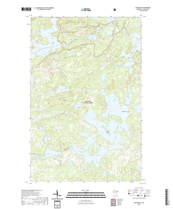
2022 Map of Lake Insula
USGS Topo · Published 2022About this map
Superior National Forest encompasses this wilderness landscape in the north woods of Minnesota, where a labyrinthine network of water bodies defines the geography. The expansive Lake Insula dominates the southeastern quadrant, featuring the prominent Williamson Island and a distinct landmark known simply as The Rock. To the west, Hudson Lake and Zitkala Lake connect via Ahmoo Cr, illustrating the complex drainage patterns that lead toward the Kawishiwi River.
Find a feature on this map
53 named features on this map. Tap any name to fly to it.
Don’t see what you’re looking for? This feature index may not catch every label — zoom into the map to look around manually.
Map Details
Editions of this 2022 Lake Insula Map
This is the sole edition of this map. No revisions or reprints were ever made.
Other maps of this area

1954 · Two Harbors
USGS Topo · 1:250,000

1957 · Two Harbors
USGS Topo · 1:250,000

1957 · Ensign Lake
USGS Topo · 1:62,500

1957 · Quetico
USGS Topo · 1:250,000

1958 · Two Harbors
USGS Topo · 1:250,000

1959 · Kekekabic Lake
USGS Topo · 1:24,000

1960 · Perent Lake
USGS Topo · 1:24,000

1960 · Alice Lake
USGS Topo · 1:24,000

1964 · Two Harbors
USGS Topo · 1:250,000

1968 · Quetico
USGS Topo · 1:250,000