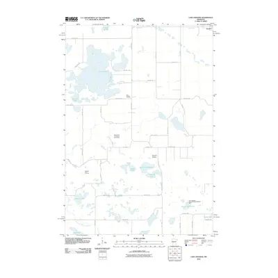
2010 Map of Lake Johanna
USGS Topo · Published 2010About this map
Lake Johanna and its surrounding wetlands anchor this prairie landscape in Stearns County during the first decade of the 2000s. The area is defined by a dense concentration of glacial lakes and water features, from the expansive Tracey Slough in the north to family-named landmarks like Hefta Lake and Ole Lake in the south. Human management of the water is evident through the Mud Creek Number 5 Group Dam and the Leif Langsjoen Waterfowl Development Dam, highlighting the importance of conservation and drainage in this agricultural region. The map provides significant genealogical value, documenting the locations of the Stockholm Family Cemetery, Lake Johanna Cemetery, and South Lake Johanna Cemetery. A grid of rural township roads and county highways connects these sites to the edge of Brooten, reflecting a long-established settlement pattern amidst the intricate lake system of Skanning Lake, Round Lake, and Rocky Mountain Lake.
Find a feature on this map
45 named features on this map. Tap any name to fly to it.
Don’t see what you’re looking for? This feature index may not catch every label — zoom into the map to look around manually.
Map Details
Editions of this 2010 Lake Johanna Map
This is the sole edition of this map. No revisions or reprints were ever made.
Other maps of this area

1953 · Saint Cloud
USGS Topo · 1:250,000

1957 · Saint Cloud
USGS Topo · 1:250,000

1958 · Saint Cloud
USGS Topo · 1:250,000

1965 · Padua
USGS Topo · 1:24,000

1965 · Sedan
USGS Topo · 1:24,000

1967 · Mount Tom
USGS Topo · 1:24,000

1967 · Sunburg
USGS Topo · 1:24,000

1967 · Belgrade
USGS Topo · 1:24,000

1967 · Lake Johanna
USGS Topo · 1:24,000

1968 · Terrace
USGS Topo · 1:24,000