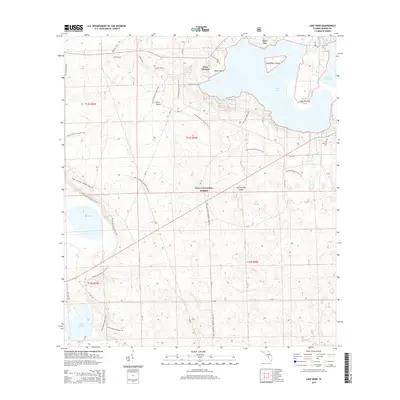
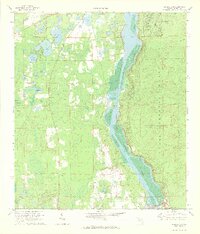
2015 Map of Lake Kerr
USGS Topo · Published 2015About this map
Kerr City and the northern reaches of the Ocala National Forest define this landscape within the Florida peninsula. The area is dominated by significant hydrologic features, centered on the expansive Lake Kerr and the smaller Little Lake Kerr to its east. Within these waters lie several named landmasses, including Kauffmans Island, Petes Island, and Lake Kerr Key. The map reveals a dense network of recreational and transit paths, such as the Florida National Scenic Trail and the Lake, Alachua, Marion (LAM) Tr, which weave through the pine and scrub environment. To the southwest, Lake Eaton and its associated Lake Eaton Loop Trail and Lake Eaton Sinkhole Tr highlight the karst topography typical of the region. Local history and genealogy interests are anchored by the First Baptist Cem near the eastern boundary and the settlement at Point Pleasant.
Find a feature on this map
24 named features on this map. Tap any name to fly to it.
Don’t see what you’re looking for? This feature index may not catch every label — zoom into the map to look around manually.
Map Details
Editions of this 2015 Lake Kerr Map
This is the sole edition of this map. No revisions or reprints were ever made.
Other maps of this area

1954 · Daytona Beach
USGS Topo · 1:250,000

1958 · Daytona Beach
USGS Topo · 1:250,000

1964 · Daytona Beach
USGS Topo · 1:250,000
1970 · Ft McCoy
USGS Topo · 1:24,000

1970 · Welaka
USGS Topo · 1:24,000
1970 · Lake Delancy
USGS Topo · 1:24,000

1970 · Salt Springs
USGS Topo · 1:24,000
1970 · Lynne
USGS Topo · 1:24,000

1970 · Halfmoon Lake
USGS Topo · 1:24,000
1970 · Eureka Dam
USGS Topo · 1:24,000