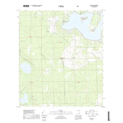
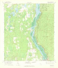
2018 Map of Lake Kerr
USGS Topo · Published 2018About this map
Kerr City sits on the northern shore of Lake Kerr, anchoring a landscape defined by the expansive Ocala National Forest. The map documents a complex aquatic environment where large bodies of water like Little Lake Kerr and Mud Lake are interspersed with named landforms such as Point Pleasant and Kauffmans Island. A significant network of recreational and utility paths traverses the terrain, most notably the Florida National Scenic Trail, which winds through the central and western portions of the quadrangle. Local history and geography are further detailed through features like the First Baptist Cem near the eastern edge and the specialized Lake Eaton Sinkhole Tr near Lake Eaton. This 2018 survey provides a clear view of the relationship between the historic settlement at Kerr City and the surrounding protected forest lands, illustrating how access routes like the Pipeline Trail and Pats Island roads penetrate this Florida wilderness.
Find a feature on this map
28 named features on this map. Tap any name to fly to it.
Don’t see what you’re looking for? This feature index may not catch every label — zoom into the map to look around manually.
Map Details
Editions of this 2018 Lake Kerr Map
This is the sole edition of this map. No revisions or reprints were ever made.
Other maps of this area

1954 · Daytona Beach
USGS Topo · 1:250,000

1958 · Daytona Beach
USGS Topo · 1:250,000

1964 · Daytona Beach
USGS Topo · 1:250,000
1970 · Ft McCoy
USGS Topo · 1:24,000

1970 · Welaka
USGS Topo · 1:24,000
1970 · Lake Delancy
USGS Topo · 1:24,000

1970 · Salt Springs
USGS Topo · 1:24,000
1970 · Lynne
USGS Topo · 1:24,000

1970 · Halfmoon Lake
USGS Topo · 1:24,000
1970 · Eureka Dam
USGS Topo · 1:24,000