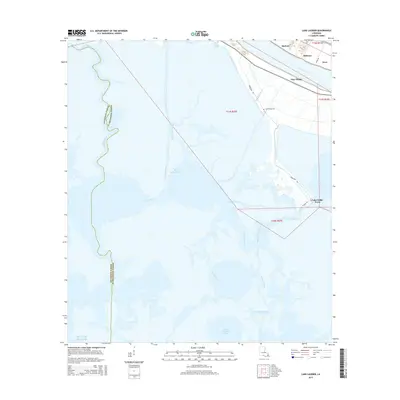
2015 Map of Lake Laurier
USGS Topo · Published 2015About this map
The Mississippi River carves through the northeastern corner of this coastal landscape, defining the narrow strip of habitable land where settlements like Harlem, Bellevue, and Nero are situated. This area in Plaquemines Parish shows the delicate balance between the river's high ground and the sprawling wetlands to the southwest. A network of man-made and natural waterways, including the Wilkinson Canal and Deer Range Canal, bisects the marsh, illustrating the historical reliance on water for transit and drainage in the delta.
Find a feature on this map
30 named features on this map. Tap any name to fly to it.
Don’t see what you’re looking for? This feature index may not catch every label — zoom into the map to look around manually.
Map Details
Editions of this 2015 Lake Laurier Map
This is the sole edition of this map. No revisions or reprints were ever made.
Other maps of this area

1891 · Pointe a La Hache
USGS Topo · 1:62,500

1892 · Barataria
USGS Topo · 1:62,500

1892 · Creole
USGS Topo · 1:62,500

1892 · Pointe a La Hache
USGS Topo · 1:62,500

1893 · Fort Livingston
USGS Topo · 1:62,500

1935 · Lake Batola
USGS Topo · 1:31,680

1935 · Wilkinson Bay
USGS Topo · 1:31,680

1939 · Pointe a La Hache
USGS Topo · 1:62,500

1941 · Barataria
USGS Topo · 1:62,500

1944 · Barataria
USGS Topo · 1:62,500