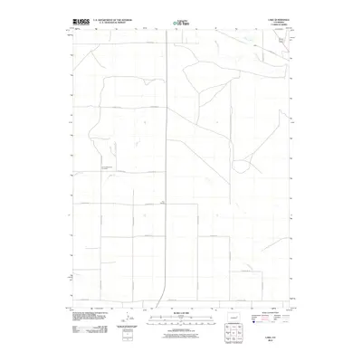
2010 Map of Lake
USGS Topo · Published 2010About this map
The Limon Mennonite Cemetery and the crossroads at Four Corners anchor this rural landscape in Elbert County. Surveyed just before 2010, the sheet highlights a geometric grid of unpaved county roads including County Rd-90 and County Rd-19, reflecting the agricultural organization of the eastern plains. Water is a defining but sparse feature, marked by the winding paths of Big Sandy Creek and Lake Creek, which leads toward the settlement of Lake. The drainage of Long Branch cuts across the southern and western sections, illustrating the natural irrigation patterns of this high-plains environment. This edition captures the area's transition into the twenty-first century, where traditional land use and cemetery sites remain central to the local geography.
Find a feature on this map
23 named features on this map. Tap any name to fly to it.
Don’t see what you’re looking for? This feature index may not catch every label — zoom into the map to look around manually.
Map Details
Editions of this 2010 Lake Map
This is the sole edition of this map. No revisions or reprints were ever made.
Other maps of this area

1891 · Limon
USGS Topo · 1:125,000

1892 · Limon
USGS Topo · 1:125,000

1954 · Limon
USGS Topo · 1:250,000

1957 · Limon
USGS Topo · 1:250,000

1958 · Limon
USGS Topo · 1:250,000
1970 · Matheson SE
USGS Topo · 1:24,000

1970 · Limon
USGS Topo · 1:24,000

1970 · Four Corners
USGS Topo · 1:24,000
1970 · Long Creek
USGS Topo · 1:24,000
1970 · Matheson NE
USGS Topo · 1:24,000