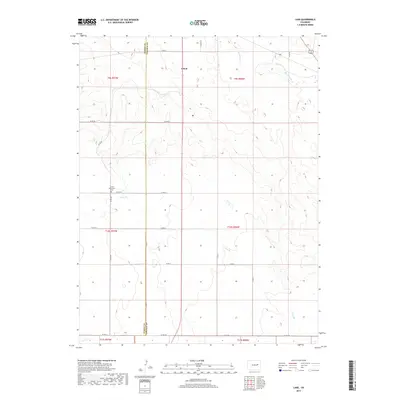
2019 Map of Lake
USGS Topo · Published 2019About this map
Limon sits at the northern edge of this high plains landscape, where the boundary between Elbert Co and Lincoln Co runs north-to-south through the terrain. The area is defined by a network of intermittent watercourses, most notably Big Sandy Cr and Lake Cr in the northeast, and the winding path of Long Br and Long Cr further south. These drainage patterns dictate the placement of the section-line roads, such as Co RD 90 and Co RD 2w, which form a rigid grid across the undulating topography. A focal point for local history is the Limon Mennonite Cem, located just west of the county line along Co RD 201. The map reveals a sparsely populated ranching or agricultural environment where the natural drainage of the Long Br basin remains the primary geographic feature alongside the rural road network.
Find a feature on this map
27 named features on this map. Tap any name to fly to it.
Don’t see what you’re looking for? This feature index may not catch every label — zoom into the map to look around manually.
Map Details
Editions of this 2019 Lake Map
This is the sole edition of this map. No revisions or reprints were ever made.
Other maps of this area

1891 · Limon
USGS Topo · 1:125,000

1892 · Limon
USGS Topo · 1:125,000

1954 · Limon
USGS Topo · 1:250,000

1957 · Limon
USGS Topo · 1:250,000

1958 · Limon
USGS Topo · 1:250,000
1970 · Matheson SE
USGS Topo · 1:24,000

1970 · Limon
USGS Topo · 1:24,000

1970 · Four Corners
USGS Topo · 1:24,000
1970 · Long Creek
USGS Topo · 1:24,000
1970 · Matheson NE
USGS Topo · 1:24,000