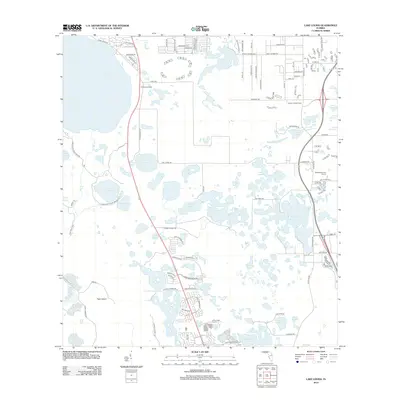
2012 Map of Lake Louisa
USGS Topo · Published 2012About this map
Lake Louisa and a dense network of smaller basins like Sawgrass Lake and Hickorynut Lake dominate this Central Florida landscape during a period of rapid residential expansion. The layout of new subdivisions is visible through named corridors such as Sawgrass Bay Blvd and Majestic Isle Dr, contrasting with older markers of the area's rural character like the Hi-Acres Airport and the Avalon Lookout Tower. The terrain is characterized by the transition from open water to marshy pockets near Tiger Island and the expansive Hancock Lake. The map details the emerging suburban footprint at the edge of the Green Swamp, showing how modern developments like the Willowbrook Golf Course were integrated into a region historically defined by its citrus groves and lakefront vistas.
Find a feature on this map
90 named features on this map. Tap any name to fly to it.
Don’t see what you’re looking for? This feature index may not catch every label — zoom into the map to look around manually.
Map Details
Editions of this 2012 Lake Louisa Map
This is the sole edition of this map. No revisions or reprints were ever made.
Other maps of this area

1953 · Windermere
USGS Topo · 1:24,000

1953 · Intercession City
USGS Topo · 1:24,000

1955 · Orlando
USGS Topo · 1:250,000

1956 · Winter Garden
USGS Topo · 1:24,000

1957 · Orlando
USGS Topo · 1:250,000

1958 · Orlando
USGS Topo · 1:250,000

1959 · Lake Nellie
USGS Topo · 1:24,000

1959 · Lake Louisa
USGS Topo · 1:24,000

1959 · Lake Louisa SW
USGS Topo · 1:24,000

1959 · Poyner
USGS Topo · 1:24,000