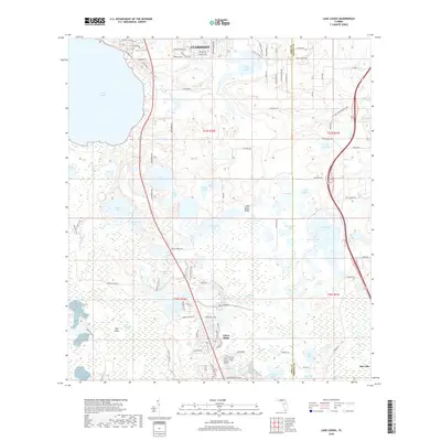
2018 Map of Lake Louisa
USGS Topo · Published 2018About this map
Clermont and the expanding development at Citrus Ridge occupy the higher ground of the Lake Wales Ridge, overlooking a landscape defined by an intricate network of freshwater lakes. The massive expanse of Lake Louisa dominates the northwest, while the eastern border at the Lake Co Orange Co line transitions into a dense cluster of water bodies including Hickorynut Lake and Lake Hancock. The southern portion of the quadrangle descends into the Green Swamp, a critical hydrologic region where the land becomes a mosaic of marshes and isolated hammocks like Tiger Island.
Find a feature on this map
101 named features on this map. Tap any name to fly to it.
Don’t see what you’re looking for? This feature index may not catch every label — zoom into the map to look around manually.
Map Details
Editions of this 2018 Lake Louisa Map
This is the sole edition of this map. No revisions or reprints were ever made.
Other maps of this area

1953 · Windermere
USGS Topo · 1:24,000

1953 · Intercession City
USGS Topo · 1:24,000

1955 · Orlando
USGS Topo · 1:250,000

1956 · Winter Garden
USGS Topo · 1:24,000

1957 · Orlando
USGS Topo · 1:250,000

1958 · Orlando
USGS Topo · 1:250,000

1959 · Lake Nellie
USGS Topo · 1:24,000

1959 · Lake Louisa
USGS Topo · 1:24,000

1959 · Lake Louisa SW
USGS Topo · 1:24,000

1959 · Poyner
USGS Topo · 1:24,000