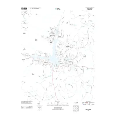
2013 Map of Lake Lure
USGS Topo · Published 2013About this map
Lake Lure and its namesake town sit at the heart of this mountain landscape, where the Broad River flows through the prominent Hickory Nut Gorge. This 2013 survey records the modern development patterns of recreational and residential communities like Fairfield Mountains, Deerfield, and Riverbend that have grown around the water. The map traces the varied terrain of the Blue Ridge foothills, from the heights of Rumbling Bald Mountain and Shumont Mountain down to the gap at Chimney Rock.
Find a feature on this map
246 named features on this map. Tap any name to fly to it.
Don’t see what you’re looking for? This feature index may not catch every label — zoom into the map to look around manually.
Map Details
Editions of this 2013 Lake Lure Map
This is the sole edition of this map. No revisions or reprints were ever made.
Other maps of this area

1900 · Mount Mitchell
USGS Topo · 1:125,000

1902 · Mount Mitchell
USGS Topo · 1:125,000

1907 · Saluda
USGS Topo · 1:125,000

1935 · Batcave
USGS Topo · 1:24,000

1935 · Black Mountain
USGS Topo · 1:24,000

1935 · Fishtop
USGS Topo · 1:24,000

1941 · Black Mountain
USGS Topo · 1:24,000
1943 · Black Mountain
USGS Topo · 1:24,000

1946 · Bat Cave
USGS Topo · 1:24,000

1946 · Cliffield Mtn
USGS Topo · 1:24,000