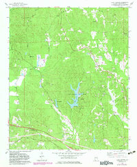
1978 Map of Lake Lurleen
USGS Topo · Published 1983About this map
Lake Lurleen State Park and the surrounding Tuscaloosa County woodlands dominate this 1970s landscape, centered on the waters of Lake Lurleen and the smaller Lake Arnedra. The terrain is defined by a dense network of creek valleys, including Big Creek, Wards Creek, and Carroll Creek, which shaped the early settlement patterns and road placements in this part of Alabama. Historic routes like Jackson Trace Road and Columbus Road intersect the area, providing a link to older travel corridors.
Find a feature on this map
36 named features on this map. Tap any name to fly to it.
Don’t see what you’re looking for? This feature index may not catch every label — zoom into the map to look around manually.
Map Details
Editions of this 1978 Lake Lurleen Map
3 editions found
Other maps of this area

1924 · Tuscaloosa
USGS Topo · 1:62,500

1926 · Samantha
USGS Topo · 1:48,000

1926 · Tuscaloosa
USGS Topo · 1:62,500

1928 · Samantha
USGS Topo · 1:62,500

1953 · Birmingham
USGS Topo · 1:250,000

1956 · Birmingham
USGS Topo · 1:250,000

1957 · Birmingham
USGS Topo · 1:250,000

1967 · Brownville
USGS Topo · 1:24,000

1967 · Elrod
USGS Topo · 1:24,000
1969 · Coker
USGS Topo · 1:24,000