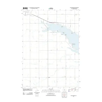
2012 Map of Lake Madison
USGS Topo · Published 2012About this map
Lake Madison dominates the landscape of Lake County, South Dakota, its shoreline punctuated by numerous recreational and geographic features including Johnson Point, Bess Point, and Walkers Point. The surrounding terrain is a grid of agricultural land and small drainage systems such as Franklin Cr and N Buffalo Cr. The settlement of Chautauqua sits at the lake's northern edge, while the community of Franklin is located to the south near Franklin Cem.
Find a feature on this map
43 named features on this map. Tap any name to fly to it.
Don’t see what you’re looking for? This feature index may not catch every label — zoom into the map to look around manually.
Map Details
Editions of this 2012 Lake Madison Map
This is the sole edition of this map. No revisions or reprints were ever made.
Other maps of this area

1953 · Watertown
USGS Topo · 1:250,000

1955 · Sioux Falls
USGS Topo · 1:250,000

1958 · Sioux Falls
USGS Topo · 1:250,000

1958 · Watertown
USGS Topo · 1:250,000

1968 · Lake Madison
USGS Topo · 1:24,000

1968 · Wentworth
USGS Topo · 1:24,000

1968 · Ramona
USGS Topo · 1:24,000

1968 · Madison
USGS Topo · 1:24,000
1968 · Colton
USGS Topo · 1:24,000
1968 · Buffalo Trading Post
USGS Topo · 1:24,000