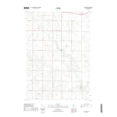
2018 Map of Lake Manakiki
USGS Topo · Published 2018About this map
The Yellow River flows through this Wood County landscape south of Marshfield, defining a region where glacial terrain meets organized rural settlement. The topography is marked by localized elevations like Cary Mound and several small water bodies including Lake Manakiki and Lake Kaunewinne. This 2018 survey reveals a well-established grid of local roads, such as Co Rd B and Co Hwy N, which connect family farms and rural homesteads.
Find a feature on this map
49 named features on this map. Tap any name to fly to it.
Don’t see what you’re looking for? This feature index may not catch every label — zoom into the map to look around manually.
Map Details
Editions of this 2018 Lake Manakiki Map
This is the sole edition of this map. No revisions or reprints were ever made.
Other maps of this area

1953 · Eau Claire
USGS Topo · 1:250,000

1954 · Granton
USGS Topo · 1:62,500

1954 · Marshfield
USGS Topo · 1:62,500

1957 · Pittsville
USGS Topo · 1:48,000

1957 · City Point
USGS Topo · 1:48,000

1958 · Eau Claire
USGS Topo · 1:250,000

1964 · Eau Claire
USGS Topo · 1:250,000

1967 · Pittsville
USGS Topo · 1:62,500

1970 · City Point NE
USGS Topo · 1:24,000
1979 · Marshfield
USGS Topo · 1:24,000