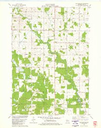
1979 Map of Lake Manakiki
USGS Topo · Published 1980About this map
The Yellow River winds through this Central Wisconsin landscape, defining the character of Wood County in the late 1970s. The map illustrates a rural region organized into the civil townships of Lincoln, Cameron, Rock, and Richfield. Settlement patterns are anchored by civic and spiritual landmarks such as the Townhall in Richfield and Trinity Ch. The area serves both as a residential agricultural zone and a recreational destination, highlighted by North Wood County Park and the distinct water bodies of Lake Manakiki and Lake Kaunewinne.
Find a feature on this map
39 named features on this map. Tap any name to fly to it.
Don’t see what you’re looking for? This feature index may not catch every label — zoom into the map to look around manually.
Map Details
Editions of this 1979 Lake Manakiki Map
This is the sole edition of this map. No revisions or reprints were ever made.
Other maps of this area

1953 · Eau Claire
USGS Topo · 1:250,000

1954 · Granton
USGS Topo · 1:62,500

1954 · Marshfield
USGS Topo · 1:62,500

1957 · Pittsville
USGS Topo · 1:48,000

1957 · City Point
USGS Topo · 1:48,000

1958 · Eau Claire
USGS Topo · 1:250,000

1964 · Eau Claire
USGS Topo · 1:250,000

1967 · Pittsville
USGS Topo · 1:62,500

1970 · City Point NE
USGS Topo · 1:24,000
1979 · Marshfield
USGS Topo · 1:24,000