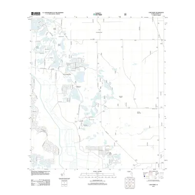
2012 Map of Lake Mary
USGS Topo · Published 2012About this map
Forest Lakes Park and the expansive Big Scrub landscape define this portion of Marion County, characterized by a complex network of freshwater basins and prairie openings. The Ocklawaha River winds through the southwestern corner, while the interior is dotted with numerous named water bodies such as Lake Mary, West Clearwater Lake, and Lake Catherine. The map reveals a high concentration of recreational infrastructure, specifically around the Doe Lake Boat Ramp and seasonal landing sites like Doe Lake Camp and Big Scrub Camp.
Find a feature on this map
96 named features on this map. Tap any name to fly to it.
Don’t see what you’re looking for? This feature index may not catch every label — zoom into the map to look around manually.
Map Details
Editions of this 2012 Lake Mary Map
This is the sole edition of this map. No revisions or reprints were ever made.
Other maps of this area

1954 · Daytona Beach
USGS Topo · 1:250,000

1955 · Orlando
USGS Topo · 1:250,000

1957 · Orlando
USGS Topo · 1:250,000

1958 · Orlando
USGS Topo · 1:250,000

1958 · Daytona Beach
USGS Topo · 1:250,000

1962 · Orlando
USGS Topo · 1:250,000

1964 · Daytona Beach
USGS Topo · 1:250,000

1965 · Umatilla
USGS Topo · 1:24,000
1966 · Lady Lake
USGS Topo · 1:24,000
1966 · Emeralda Island
USGS Topo · 1:24,000