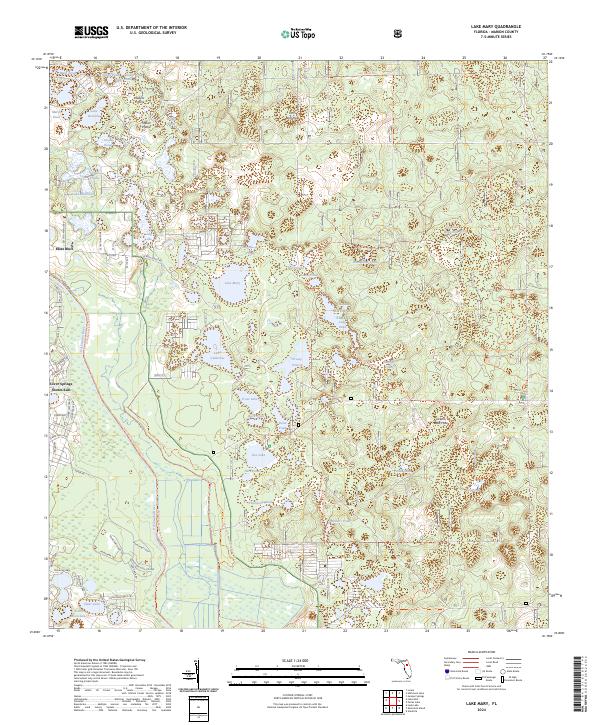
2024 Map of Lake Mary
USGS Topo · Published 2024About this map
Ocala National Forest dominates this landscape, where the sandy scrub and pine flatwoods of Marion County are punctuated by a dense network of karst ponds and grassy openings. This area is defined by its transition from the wet prairies, such as Grassy Prairie and Sellers Prairie, to the deep interior water bodies of the national forest. Named features like Lake Mary, Lake Catherine, and the recreational hub at Doe Lake are central to the region's geography. The map reveals the intricate network of forest roads and trails, including the Prairie Riding Loop Trl and Centennial Trl, which navigate the complex terrain. On the western edge, the small settlements of Moss Bluff and Silver Springs Shores East represent the interface between developed residential zones and the protected wildlife corridors of the Sunnyhill Restoration Area Trl. Unusual local landmarks like Forts Bear Hole and Volusia Bear Hole point to the area's natural sinkholes and distinctive animal habitats.
Find a feature on this map
75 named features on this map. Tap any name to fly to it.
Don’t see what you’re looking for? This feature index may not catch every label — zoom into the map to look around manually.
Map Details
Editions of this 2024 Lake Mary Map
This is the sole edition of this map. No revisions or reprints were ever made.
Other maps of this area

1954 · Daytona Beach
USGS Topo · 1:250,000

1955 · Orlando
USGS Topo · 1:250,000

1957 · Orlando
USGS Topo · 1:250,000

1958 · Orlando
USGS Topo · 1:250,000

1958 · Daytona Beach
USGS Topo · 1:250,000

1962 · Orlando
USGS Topo · 1:250,000

1964 · Daytona Beach
USGS Topo · 1:250,000

1965 · Umatilla
USGS Topo · 1:24,000
1966 · Lady Lake
USGS Topo · 1:24,000
1966 · Emeralda Island
USGS Topo · 1:24,000