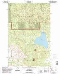
1994 Map of Lake Mary Ronan
USGS Topo · Published 1996About this map
Lake Mary Ronan sits at the heart of this northwestern Montana landscape, where the southern reaches of the Flathead National Forest meet the northern boundary of the Flathead Indian Reservation. This 1994 revision shows a terrain defined by high ridges and recreational hubs, from the Blacktail Mountain area in the north down to the Hog Heaven Range. Small shoreline settlements and landings like Meltons, Sipes, and Lambeth dot the eastern edge of the lake, alongside Lake Mary Ronan State Park. The map documents a complex network of forest access, including the Wild Bill ORV Nat Rec Trail and the winding Burma Road. To the south, the landscape opens into Big Meadows near the headwaters of Ronan Creek, illustrating the transition from dense timber to open valley floor near Cromwell.
Find a feature on this map
30 named features on this map. Tap any name to fly to it.
Don’t see what you’re looking for? This feature index may not catch every label — zoom into the map to look around manually.
Map Details
Editions of this 1994 Lake Mary Ronan Map
2 editions found
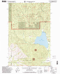
Other maps of this area

1920 · Flathead Lake
USGS Topo · 1:125,000

1943 · Kalispell
USGS Topo · 1:125,000

1956 · Wallace
USGS Topo · 1:250,000

1957 · Kalispell
USGS Topo · 1:250,000

1960 · Kalispell
USGS Topo · 1:250,000

1960 · Wallace
USGS Topo · 1:250,000

1961 · Kalispell
USGS Topo · 1:250,000

1962 · Kila
USGS Topo · 1:24,000

1962 · Lion Mountain
USGS Topo · 1:24,000

1964 · Irvine Lookout Tower
USGS Topo · 1:24,000