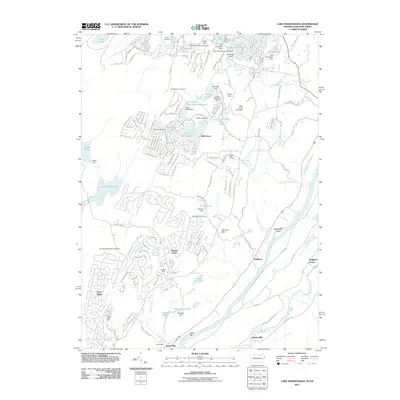
2011 Map of Lake Maskenozha
USGS Topo · Published 2011About this map
Dingmans Falls and a series of dramatic cascades including Silverthread Falls, Factory Falls, and Fulmer Falls define the steep drainage of Dingmans Creek as it approaches the Delaware River valley. This 2011 survey captures a landscape transition between the residential developments of Wild Acres and Ranch Lands and the protected terrain of the river corridor. To the south, the map details the rural character of Wallpack Center and Egypt Mills, where the winding Delaware River surrounds Shapanack Island. Historically significant sites like Haneys Mill and the Dry Meadow Fire Tower are situated among a high density of managed water bodies, such as Lake Maskenozha and the Long Ridge Reservation Reservoir, which illustrate the region's complex water management and recreational infrastructure.
Find a feature on this map
184 named features on this map. Tap any name to fly to it.
Don’t see what you’re looking for? This feature index may not catch every label — zoom into the map to look around manually.
Map Details
Editions of this 2011 Lake Maskenozha Map
This is the sole edition of this map. No revisions or reprints were ever made.
Other maps of this area

1891 · Wallpack
USGS Topo · 1:62,500

1893 · Wallpack
USGS Topo · 1:62,500

1913 · Milford
USGS Topo · 1:62,500

1915 · Milford
USGS Topo · 1:62,500

1924 · Bushkill
USGS Topo · 1:48,000

1935 · Hawley
USGS Topo · 1:62,500

1938 · Hawley
USGS Topo · 1:62,500

1943 · Bushkill
USGS Topo · 1:62,500

1943 · Lake Maskenozha
USGS Topo · 1:31,680
1943 · Culvers Gap
USGS Topo · 1:31,680
Featured Places
- Delaware, Lehman Township
- Stillwater Township, NJ
- Wallpack Center, Walpack Township
- Walpack Township, NJ
- Lehman Township, PA