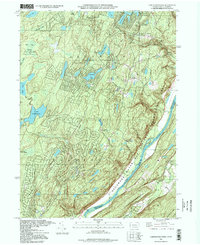
1995 Map of Lake Maskenozha
USGS Topo · Published 1998About this map
Lake Maskenozha and the surrounding woodlands of the Delaware State Forest characterize this landscape in the mid-1990s. The map captures a transitional geography where private recreational developments like Wild Acres and seasonal sites such as Camp Massad and Camp Fire Camp sit adjacent to vast public lands. The eastern edge is defined by the steep descent toward the Delaware River, which serves as the boundary between Pike and Sussex Counties.
Find a feature on this map
49 named features on this map. Tap any name to fly to it.
Don’t see what you’re looking for? This feature index may not catch every label — zoom into the map to look around manually.
Map Details
Editions of this 1995 Lake Maskenozha Map
This is the sole edition of this map. No revisions or reprints were ever made.
Other maps of this area

1891 · Wallpack
USGS Topo · 1:62,500

1893 · Wallpack
USGS Topo · 1:62,500

1913 · Milford
USGS Topo · 1:62,500

1915 · Milford
USGS Topo · 1:62,500

1924 · Bushkill
USGS Topo · 1:48,000

1935 · Hawley
USGS Topo · 1:62,500

1938 · Hawley
USGS Topo · 1:62,500

1943 · Bushkill
USGS Topo · 1:62,500

1943 · Lake Maskenozha
USGS Topo · 1:31,680
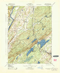
1943 · Culvers Gap
USGS Topo · 1:31,680
Featured Places
- Delaware, Lehman Township
- Stillwater Township, NJ
- Wallpack Center, Walpack Township
- Lehman Township, PA
- Wild Acres, Delaware Township