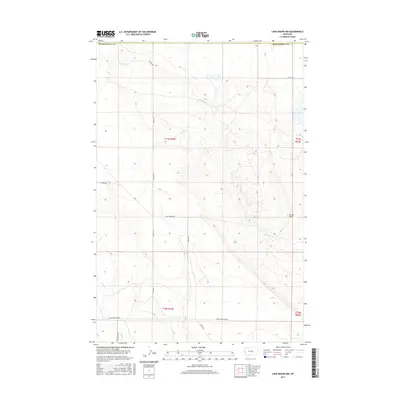
2017 Map of Lake Mason NW
USGS Topo · Published 2017About this map
Devils Basin dominates the eastern landscape of this Fergus County territory, where the drainage of N Willow Cr and its tributaries carve through the central Montana terrain. The map captures a section of the High Plains transition defined by significant elevation changes and a network of rural roads that often bear the names of local families. These routes, including Graves Rd, Gary Graves Rd, and Harris Rd, provide a skeletal framework for the land divisions across townships such as t11n r24e and t10n r25e. Toward the southern reaches, the land descends toward Snowy Mountain Rd and the headwaters of Jones Cr, illustrating the watershed divide between the Musselshell County border and the surrounding prairie. This 2017 survey reflects the enduring cadastral patterns of the American West, where section lines and creek beds remain the primary markers of human and natural history.
Find a feature on this map
16 named features on this map. Tap any name to fly to it.
Don’t see what you’re looking for? This feature index may not catch every label — zoom into the map to look around manually.
Map Details
Editions of this 2017 Lake Mason NW Map
This is the sole edition of this map. No revisions or reprints were ever made.
Other maps of this area

1954 · Roundup
USGS Topo · 1:250,000

1958 · Roundup
USGS Topo · 1:250,000

1986 · Tyler
USGS Topo · 1:24,000

1986 · Lake Mason SE
USGS Topo · 1:24,000

1986 · Pender Coulee
USGS Topo · 1:24,000

1986 · Pike Creek Hills West
USGS Topo · 1:24,000

1986 · Lake Mason NE
USGS Topo · 1:24,000

1986 · Lake Mason NW
USGS Topo · 1:24,000

1986 · Pike Creek Hills East
USGS Topo · 1:24,000
1986 · Timber Buttes North
USGS Topo · 1:24,000