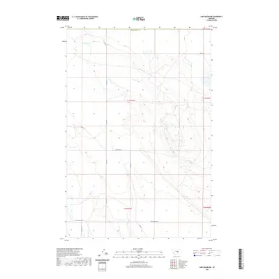
2020 Map of Lake Mason NW
USGS Topo · Published 2020About this map
N Willow Cr and Jones Cr wind through this expansive landscape in Fergus County, defining the drainage patterns south of the Musselshell Co border. The map reveals a network of rural roads that reflect the land use and ranching history of the area, including Graves Rd, Shipp Rd, and Kombol Rd. To the south, the terrain transitions near the base of the mountains, marked by Snowy Mountain Rd and the headwaters of Willow Cr. The naming of local routes such as Gary Graves Rd and Harris Rd provides essential clues for genealogists and local historians tracking family landholdings and historical access points in this part of Montana.
Find a feature on this map
16 named features on this map. Tap any name to fly to it.
Don’t see what you’re looking for? This feature index may not catch every label — zoom into the map to look around manually.
Map Details
Editions of this 2020 Lake Mason NW Map
This is the sole edition of this map. No revisions or reprints were ever made.
Other maps of this area

1954 · Roundup
USGS Topo · 1:250,000

1958 · Roundup
USGS Topo · 1:250,000

1986 · Tyler
USGS Topo · 1:24,000

1986 · Lake Mason SE
USGS Topo · 1:24,000

1986 · Pender Coulee
USGS Topo · 1:24,000

1986 · Pike Creek Hills West
USGS Topo · 1:24,000

1986 · Lake Mason NE
USGS Topo · 1:24,000

1986 · Lake Mason NW
USGS Topo · 1:24,000

1986 · Pike Creek Hills East
USGS Topo · 1:24,000
1986 · Timber Buttes North
USGS Topo · 1:24,000