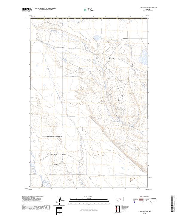
2024 Map of Lake Mason NW
USGS Topo · Published 2024About this map
Lake Mason National Wildlife Refuge anchors the southern reaches of this landscape, where the seasonal waters of Willow Creek and Jones Creek define the local topography. This 2024 survey depicts a sparsely settled corner of Musselshell County, characterized by a grid of rural tracks like Snowy Mountain Rd and Lake Mason Rd that navigate the drainages of the North Willow Creek. The land is marked by significant elevation contours and section boundaries, illustrating the contemporary management of this protected habitat and the surrounding open rangeland. The presence of family-named thoroughfares such as Graves Rd and Gary Graves Rd suggests a long-standing ranching or homesteading history in this central Montana territory.
Find a feature on this map
16 named features on this map. Tap any name to fly to it.
Don’t see what you’re looking for? This feature index may not catch every label — zoom into the map to look around manually.
Map Details
Editions of this 2024 Lake Mason NW Map
This is the sole edition of this map. No revisions or reprints were ever made.
Other maps of this area

1954 · Roundup
USGS Topo · 1:250,000

1958 · Roundup
USGS Topo · 1:250,000

1986 · Tyler
USGS Topo · 1:24,000

1986 · Lake Mason SE
USGS Topo · 1:24,000

1986 · Pender Coulee
USGS Topo · 1:24,000

1986 · Pike Creek Hills West
USGS Topo · 1:24,000

1986 · Lake Mason NE
USGS Topo · 1:24,000

1986 · Lake Mason NW
USGS Topo · 1:24,000

1986 · Pike Creek Hills East
USGS Topo · 1:24,000
1986 · Timber Buttes North
USGS Topo · 1:24,000