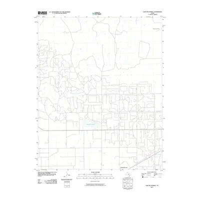
2010 Map of Lake McConnell
USGS Topo · Published 2010About this map
Lake McConnell serves as a central hydrological feature in this section of Gray County, situated amidst a grid of rural roads and agricultural plots. The landscape is characterized by the headwaters of White Deer Creek in the northwest, flowing through a region defined by its oil and gas infrastructure and aviation history. Just south of the lake, Kingsmill Camp represents a localized pocket of activity along the major east-west highway corridor, while the northeast corner is dominated by Perry Lefors Field, indicating the importance of regional air transport. A dense network of county roads, including Co Rd Dd and the numbered Gray County routes, creates a patchwork pattern typical of the Texas Panhandle's developed plains. This 2010 survey reflects a period of modern rural organization where historic camp settlements and aviation facilities coexist with established drainage systems and residential avenues like W Kentucky Ave.
Find a feature on this map
25 named features on this map. Tap any name to fly to it.
Don’t see what you’re looking for? This feature index may not catch every label — zoom into the map to look around manually.
Map Details
Editions of this 2010 Lake McConnell Map
This is the sole edition of this map. No revisions or reprints were ever made.
Other maps of this area

1954 · Amarillo
USGS Topo · 1:250,000

1958 · Amarillo
USGS Topo · 1:250,000

1963 · Pampa
USGS Topo · 1:24,000

1963 · Skellytown
USGS Topo · 1:24,000

1965 · White Deer
USGS Topo · 1:24,000

1965 · Lake Mc Connell
USGS Topo · 1:24,000

1966 · Kingsmill
USGS Topo · 1:24,000

1966 · Bowers City
USGS Topo · 1:24,000

1971 · Skellytown NW
USGS Topo · 1:24,000

1971 · Skellytown NE
USGS Topo · 1:24,000