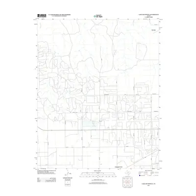
2013 Map of Lake McConnell
USGS Topo · Published 2013About this map
Lake McConnell serves as a central point in this part of Gray County, surrounded by an extensive network of rural roads and infrastructure dedicated to the region's energy and ranching sectors. The landscape is defined by the headwaters of White Deer Creek and a dense web of local routes like Arrington Rnch and Gulf Camp Rd, which reflect the area's history of petroleum extraction and cattle operations. Evidence of industrial development is visible through the prominent pipelines crossing the territory and specialized locations such as Cities Service. Near the southern boundary, Kingsmill Camp stands as a notable settlement point, while the Perry Lefors Field Airport in the northeast corner provides a critical transportation link for this Panhandle community. The grid of roads, many bearing family names like Mosley and Kretz Meier, underscores the enduring local ownership and agricultural heritage of the plains.
Find a feature on this map
41 named features on this map. Tap any name to fly to it.
Don’t see what you’re looking for? This feature index may not catch every label — zoom into the map to look around manually.
Map Details
Editions of this 2013 Lake McConnell Map
This is the sole edition of this map. No revisions or reprints were ever made.
Other maps of this area

1954 · Amarillo
USGS Topo · 1:250,000

1958 · Amarillo
USGS Topo · 1:250,000

1963 · Pampa
USGS Topo · 1:24,000

1963 · Skellytown
USGS Topo · 1:24,000

1965 · White Deer
USGS Topo · 1:24,000

1965 · Lake Mc Connell
USGS Topo · 1:24,000

1966 · Kingsmill
USGS Topo · 1:24,000

1966 · Bowers City
USGS Topo · 1:24,000

1971 · Skellytown NW
USGS Topo · 1:24,000

1971 · Skellytown NE
USGS Topo · 1:24,000