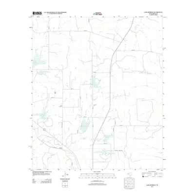
2013 Map of Lake Merritt
USGS Topo · Published 2013About this map
Bozar sits at the intersection of Ranch Road 1029 and several rural routes in this section of Mills County. The landscape is defined by extensive water management infrastructure, most notably the Lake Merritt reservoir and a series of numbered projects such as the Brown Mullin Watershed Reservoir Number Seven and Soil Conservation Service Site 4 Reservoir. These engineered features, coupled with natural waterways like Cowhouse Cr and Mustang Cr, reveal the critical importance of water conservation for the local ranching and agricultural economy.
Find a feature on this map
35 named features on this map. Tap any name to fly to it.
Don’t see what you’re looking for? This feature index may not catch every label — zoom into the map to look around manually.
Map Details
Editions of this 2013 Lake Merritt Map
This is the sole edition of this map. No revisions or reprints were ever made.
Other maps of this area

1885 · San Saba
USGS Topo · 1:125,000

1887 · Lampasas
USGS Topo · 1:125,000

1888 · Hamilton
USGS Topo · 1:125,000

1889 · Brownwood
USGS Topo · 1:125,000

1894 · Hamilton
USGS Topo · 1:125,000

1894 · Lampasas
USGS Topo · 1:125,000

1894 · Brownwood
USGS Topo · 1:125,000

1894 · San Saba
USGS Topo · 1:125,000

1925 · San Saba 1-b
USGS Topo · 1:48,000

1925 · Brownwood 4-c
USGS Topo · 1:48,000