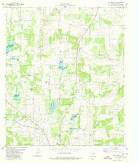
1979 Map of Lake Merritt
USGS Topo · Published 1980About this map
Lake Merritt and the surrounding ranching country of Mills County define this late-1970s landscape, where the terrain is carved by a network of seasonal drainages including Mountain Creek, Browns Creek, and Cowhouse Creek. The area is characterized by scattered rural infrastructure, featuring numerous wells and gravel pits that supported local industry and agriculture. Transportation through the region was anchored by the Atchison Topeka and Santa Fe railroad, which cuts across the southern portion of the sheet.
Find a feature on this map
12 named features on this map. Tap any name to fly to it.
Don’t see what you’re looking for? This feature index may not catch every label — zoom into the map to look around manually.
Map Details
Editions of this 1979 Lake Merritt Map
This is the sole edition of this map. No revisions or reprints were ever made.
Other maps of this area

1885 · San Saba
USGS Topo · 1:125,000

1887 · Lampasas
USGS Topo · 1:125,000

1888 · Hamilton
USGS Topo · 1:125,000

1889 · Brownwood
USGS Topo · 1:125,000

1894 · Hamilton
USGS Topo · 1:125,000

1894 · Lampasas
USGS Topo · 1:125,000

1894 · Brownwood
USGS Topo · 1:125,000

1894 · San Saba
USGS Topo · 1:125,000

1925 · San Saba 1-b
USGS Topo · 1:48,000

1925 · Brownwood 4-c
USGS Topo · 1:48,000